Cartes.gouv.fr Challenges Google Maps and Street View in France
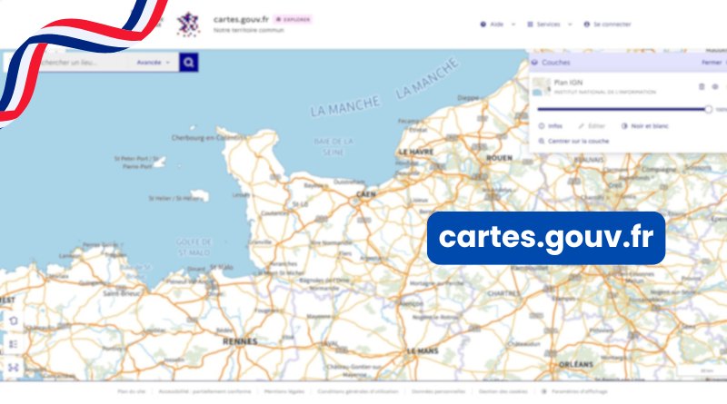
87% of French people reportedly want public, sovereign mapping tools. IGN is answering that demand. Since June 25, 2026, the Institut national de l'information géographique et forestière has opened cartes.gouv.fr, its new mapping service, to the general public. More than 1,100 data layers, a French alternative to Google Street View built in, and the scheduled retirement of Géoportail: here’s what you need to know.
Table of Contents
A single entry point to replace Géoportail
Cartes.gouv.fr is not just another map website. IGN’s goal is to bring together in one place services that were previously spread across several platforms: geoportail.gouv.fr, geoservices.ign.fr, macarte.ign.fr, and espacecollaboratif.ign.fr. This new site is therefore meant to take over most of their data and features, while adding new ones.
In any case, the schedule is already set. According to IGN, the platform was first launched in December 2025 for professionals, before this public release. It already claims around 200,000 visits per month. As for Géoportail, it will shut down very soon: as early as September 2026.
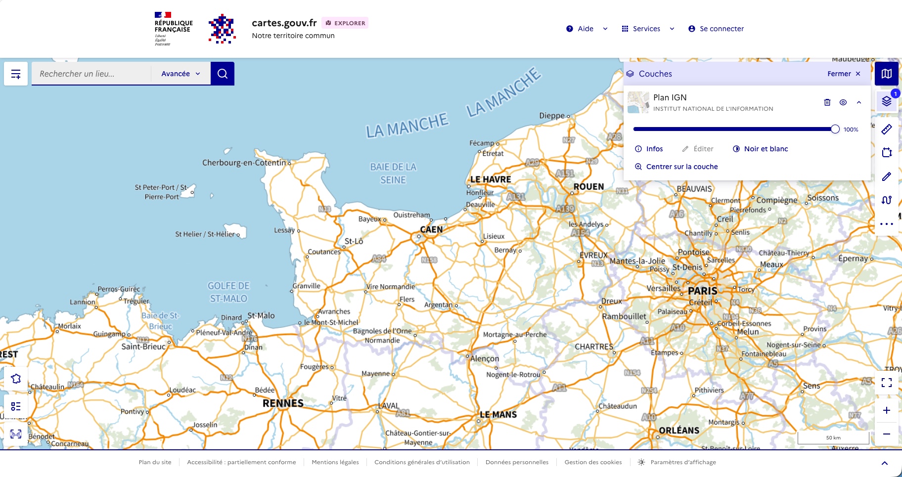
On the content side, the catalog now includes more than 1,100 map layers, supplied by IGN as well as partners such as INSEE, the Office national des forêts (ONF), and the Office français de la biodiversité (OFB). This makes it possible to offer aerial imagery, cadastral data, historical maps, urban planning, agriculture, forests, renewable energy, and demographics. The platform also integrates data from the LiDAR HD program, a 3D laser mapping system that renders terrain with great precision.
This new free service comes with a toolbox: address search, route planning or elevation profile calculation, distance and area measurement, coordinate display, annotation, printing, and sharing of custom maps. The interface has also been redesigned for mobile and tablet use, with a clear focus on accessibility. That is an important point for anyone who wants to use this tool directly in the field on a tablet, which is likely to be common.
Panoramax, the sovereign Street View with 110 million photos
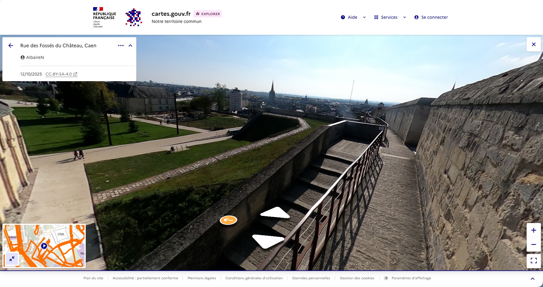
This is probably the most anticipated feature. Cartes.gouv.fr integrates Panoramax (guys, you could have called it Panoramix), an immersive street-level viewing service presented as an alternative to Google Street View. This tool is co-developed by IGN and OpenStreetMap France.
The database already includes nearly 110 million photos, but IGN acknowledges that it is still under active development and does not yet cover the entire territory. Unlike Google’s tool, Panoramax is built around a true collaborative model: anyone can contribute by uploading their own images taken from public spaces. That makes it possible to document details that aerial imagery does not capture: facades, signage, street furniture, or road conditions.
Below is a photo taken by a pedestrian inside Caen Castle. A great example of a user contribution: this is not available on Google Street View.
In a few key points, Panoramax is:
- Completely free to use for viewing (no ads, no ad tracking).
- Sovereign hosting in France, with OVHcloud.
- Original-quality export of images, something Google and Apple do not offer.
- Data hosting offered to public-sector and professional organizations up to 500 GB, according to IGN.
One limitation remains, and IGN is not hiding it. In a segment dominated by Google Maps and Waze, its survey shows that the information users most want is precisely places and points of interest (mentioned by 41% of respondents). For now, therefore, cartes.gouv.fr will not yet replace the American tools in that respect, especially when it comes to finding a store or everyday service.
87% of French people support a public map service
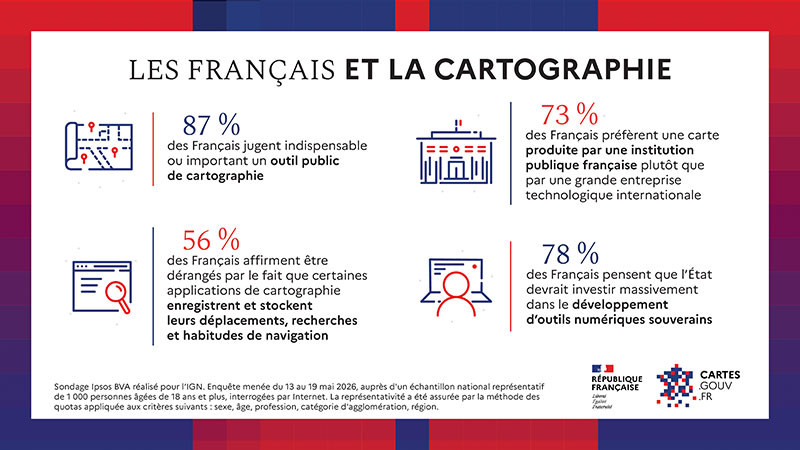
According to an Ipsos BVA survey conducted for IGN between May 13 and 19, 2026, among 1,000 people aged 18 and over, 87% of French people consider it essential or important for the state to develop and manage its own mapping tools. Another figure seemed especially high to me: 81% say they are ready to change their habits to adopt a sovereign tool. I’ll believe it when I see it.
In any case, data protection plays an important role in tool selection: 56% of respondents say they are bothered by the fact that some apps record their movements and browsing habits. "The French are convinced that the state must take hold of the issue, and there is a real sensitivity to the sovereignty challenge posed by such a tool.", Ipsos BVA explains in the document published by IGN.
This push for a sovereign alternative offered by the state is not an isolated move. As you know, there has also been the rollout of Visio, the French alternative to Microsoft Teams and Google Meet, as well as the DGSI’s decision to replace Palantir with ChapsVision. Mapping is now joining the list of digital building blocks that the state wants to bring back in-house.
Want to try this new tool? Go to this page: cartes.gouv.fr
Will you use cartes.gouv.fr every day, or is Google Maps still unbeatable for you?